 |
46.
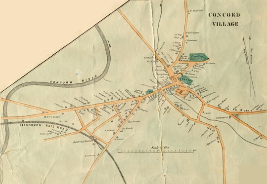
H.F. Walling. Concord Village. Inset from Map of
the Town of Concord, Middlesex County, Mass. … , 1852. Engraved
map, printed on paper, and hand-colored.
The 1852 Walling map of Concord identifies the residents of the houses it depicts, thereby providing invaluable documentation of Concord as a community and of the neighborhoods within it. The inset shows Emerson’s home on the Cambridge Turnpike. The sections of the Walling map depicting Walden Pond and White Pond (not shown here) were based on surveys done by Henry Thoreau. The Concord Free Public Library holds Thoreau’s original manuscript surveys of both Walden and White Ponds.
No image in this online display may be reproduced in any form, including electronic, without permission from the Curator of Special Collections of the Concord Free Public Library.
Next Entry - Back to Section VI Contents Listing - Back to Exhibition Introduction - Back to Exhibition Table of Contents |