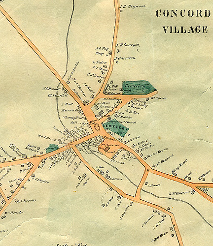

10. Walling Map, 1852
The 1852 map of Concord - part of an extensive Massachusetts mapping project by Henry F. Walling - is a valuable resource for nineteenth century research. It includes an inset displaying the town center in detail. The inset (a section of which is shown here) includes identification of the buildings around Monument Square - the Middlesex Hotel, the Middlesex County jail, the County House, the Masonic Hall, the properties of Nehemiah Ball, Daniel Shattuck, Maria and Jane Thoreau (aunts of Henry David Thoreau), the courthouse, and the newly constructed Town House (here labeled “Town Hall”). Walling's printed “Remarks” on the map include the following statement: “White Pond & Walden Pond from Surveys by H.D. Thoreau, Civ. Engr.”