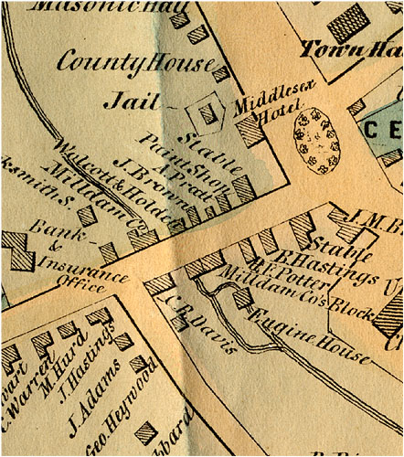
8. Concord Mill Dam Company Properties on the Walling Map, 1852
This detail of the 1852 Walling map shows the structure on the north side of the Mill Dam now called the Anderson Market building. (It is labeled “Milldam Co.” on the map.) The Mill Brook is shown running beneath it. Opposite, on the south side, are structures labeled “Milldam Co’s Block” (the section later known as Heywood’s Block).
In 1853, the year after the Walling map was published, the Concord Mill Dam Company sold the present 42-44 Main Street and the property beside it at auction. Records of the company’s transactions taper off around 1853-1854. In the Acts and Resolves Passed by the General Court of Massachusetts, in the Year 1873 (Chapter 327, “An Act to Dissolve Certain Corporations”) lists the Concord Mill Dam Company, along with the short-lived Concord Steam Mill Company, among Massachusetts businesses dissolved in that year, “if they had not been previously.”