North Corner of Original Concord Bounds Rediscovered This Week
Concord Journal, January 28, 1954
The location of Berry Corner, the original northwest corner of Concord, was rediscovered this week by Donald Lapham, Carlisle historian and member of the Appalachian Mountain Club. The pile of lichen-covered rocks was pointed out in 1880 to Charles H. Walcott, author of Concord in the Colonial Period, by B. F. Heald, descendant of the family which had owned the farm in the corner for over 200 years. In recent years Mr. Lapham has tried many times in vain to find it. Old timers who thought they knew the location offered to point it out and Mr. Lapham had many pleasant walks in the woods but the pile was never found.
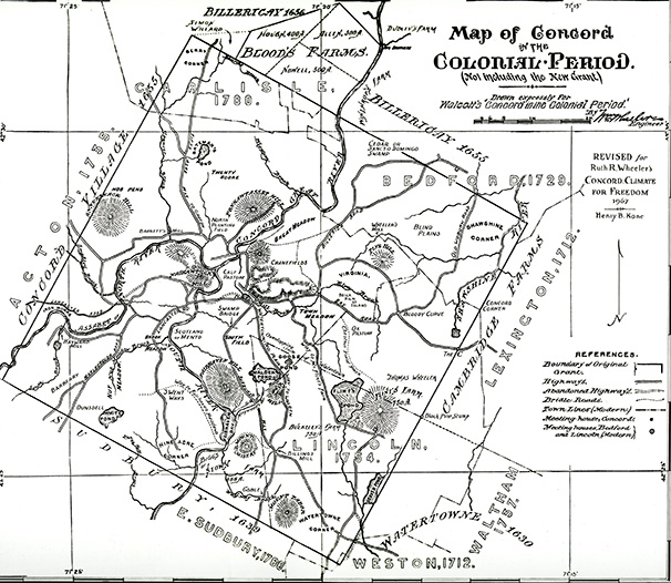
In addition to his White Mountain hikes, Mr. Lapham plans a series of walks each year to points of interest in Carlisle and also makes hikes with his scout troop. He enlisted the aid of Concord old timers but none knew the location except vaguely so Mr. Lapham was understandably happy when his last Sunday walk took him to the pile of lichen-covered rocks described by Walcott. It is near Laurence Ward’s orchard, west of Cross Street, and north of South Street, on the edge of land purchased by Mr. Ward from Dr. Lunt, and is in line with an old stone wall behind the old Carrie Robbins place, a wall which presumably followed the old line between Acton and Concord.
This pile of rocks is the oldest mark of civilization in this region, barring the discovery of Viking remains. The rocks were actually put in place by the founders of Concord, Simon Willard, William Buttrick and the rest, and the heap, once visited every few years by the Selectmen in their “perambulation of the towns bounds,” remained a landmark until Carlisle was founded to take in this corner of old Concord.