4. The Concord Center Inset of the 1852 Walling Map
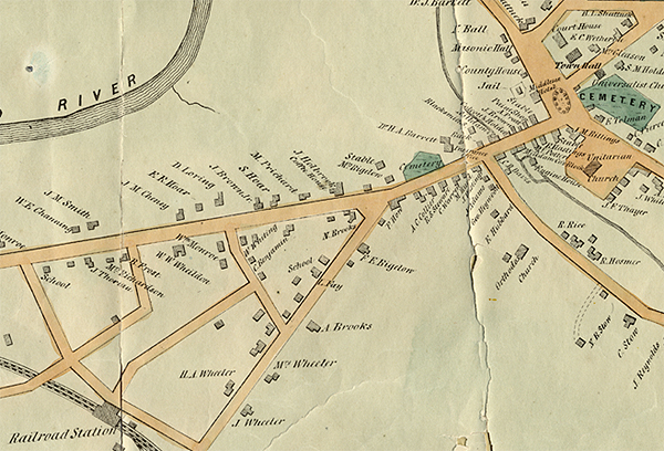
This section of the Concord Center inset of the 1852 Walling map of Concord (published two years after Thoreau prepared his survey of the area around the proposed new road between Academy Lane and the Concord Depot ) shows Middle Street as a completed road. Twenty years after the Walling map appeared, Main Street through Concord Center would be widened from the corner of Walden Street west to the Brooks House/Concord Free Public Library site, in anticipation of the increased traffic that the new library would create.
Support for the Concord Historic Buildings Website was provided in part by contributions to the Bradley P. Dean Memorial Fund.
© 2007 Concord Free Public Library. No part of this site - text or image - may be reproduced in any form without permission from the Concord Free Public Library.
Contact/Feedback: Webmaster Get help viewing and using the site
![]()
 Web design: Tracey Zellmann