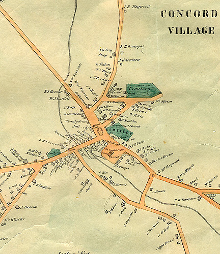
10. Walling Map, 1852
The 1852 map of Concord - part of an extensive Massachusetts mapping project by Henry F. Walling - is a valuable resource for nineteenth century research. It includes an inset displaying the town center in detail. The inset (a section of which is shown here) includes identification of the buildings around Monument Square - the Middlesex Hotel, the Middlesex County jail, the County House, the Masonic Hall, the properties of Nehemiah Ball, Daniel Shattuck, Maria and Jane Thoreau (aunts of Henry David Thoreau), the courthouse, and the newly constructed Town House (here labeled "Town Hall"). Walling's printed "Remarks" on the map include the following statement: "White Pond & Walden Pond from Surveys by H.D. Thoreau, Civ. Engr."
Support for the Concord Historic Buildings Website was provided in part by contributions to the Bradley P. Dean Memorial Fund.
© 2006 Concord Free Public Library. No part of this site - text or image - may be reproduced in any form without permission from the Concord Free Public Library.
Contact/Feedback: Webmaster Get help viewing and using the site
![]()
 Web design: Tracey Zellmann