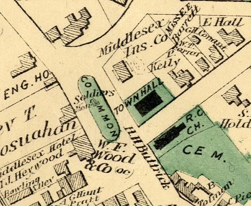
31. Beers Map, 1875
In the second half of the nineteenth century, the Beers Company of New York compiled and published a series of county atlases that today provide detailed information on the evolution of the built landscape of many American towns. This close-up of Concord's Monument Square area comes from a larger map in the 1875 Beers Middlesex County atlas (County Atlas of Middlesex Massachusetts. From actual Surveys by and under the Direction of F.W. Beers. Published by J.B. Beers & Co.). The maps in this atlas were engraved by L.E. Neuman and printed by Charles Hart.
Support for the Concord Historic Buildings Website was provided in part by contributions to the Bradley P. Dean Memorial Fund.
© 2006 Concord Free Public Library. No part of this site - text or image - may be reproduced in any form without permission from the Concord Free Public Library.
Contact/Feedback: Webmaster Get help viewing and using the site
![]()
 Web design: Tracey Zellmann