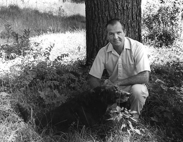
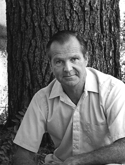
Gordon Hutchins Shaw
120 Musketaquid Road
Age 57
Interviewed May 19, 1992
Concord Oral History Program.
Renee Garrelick, Interviewer.
 The Nashawtuc Hill neighborhood
The Shaw and Hutchins families
Change of ownership and relationship to land use
William Wheeler
Land conservation efforts
Formation of Concord Land Conservation Trust
Private donations
Wright land between Walden Pond, Fairhaven Bay,
Fairhaven Hill and Lincoln town line
Protection of the Spencer Brook Valley, donations by
Russell Clarke, Alan Bemis, Bert and Anne Newbury
Purchase of Unisys property
Trust for Public Lands
Sudbury Valley Trustees
I've always lived in the Nashawtuc Hill neighborhood. I grew up here, then went away for a short while to school and did some service in the Army and lived briefly in Boston, but very shortly thereafter moved back to the Nashawtuc area and have lived either in the house that was originally my grandparents, Walter and Mary Shaw, at 235 Nashawtuc Road or in my parents' house at 275 Nashawtuc Road which is on the other side of the sledding hill. The sledding hill was purchased by my grandfather so that it could be preserved for the benefit of the townspeople.
My grandfather, Walter Shaw, lived in Lexington and in the late 1880s used to come to Concord to canoe on the river and to play tennis with George Keyes and Mr. Sawyer. He would walk over or run in the morning from Lexington to Concord to meet with his friends, grab a hasty breakfast and then take a train to Boston arriving at 9:00 in time to begin his work day, often returning the same route. They had a very full day in those times. While he was here, he met Mary Hutchins, the daughter of the Rev. Charles Hutchins who lived on Punkatasset Hill. Charles Hutchins became my grandfather. Charles Hutchins daughter, Mary, eventually married my grandfather and therefore became my grandmother. Her father came to Concord to buy some farm equipment at an auction that was being held at a farm on Punkatasset. He was so intrigued with the farm after buying the piece of equipment that he wanted that he stayed around after the auction and ended up buying the farm. He moved his family to Punkatasset which then consisted of the land that is from the river back up to what is now known as Hutchins Farm run by the Bemis family currently. They also are descendants of Mr. Hutchins. Mr. Hutchins then accumulated much of the land back through Estabrook Woods all the way into Carlisle.
My grandparents moved to Nashawtuc Hill shortly after they were married and built their home at what is now 235 Nashawtuc Hill Road which is where my father Walter Shaw Jr. was born. As I indicated, Walter Shaw Jr. when he was married then moved into his home at 275 Nashawtuc Road. My mother was Helen Sargent Shaw and they lived there all their lives.
I'd like to talk a little bit about my memories and what I've read about Nashawtuc Hill as an example of how land use has changed in Concord. I've read a piece, a small pamphlet, put together by Grindell Reynolds in 1883, called "A Story of a Concord Farm." He traces the history of this small hill between the three rivers, the Sudbury, Assabet, and Concord Rivers. He traces the use of the hill from its Indian ownership or Indian use that they had of the land right through the late 1880s. He begins where Simon Willard first owned all of this hill. At that time, of course, there was no Nashawtuc Road. The bridge and the causeway that run through the meadows did not exist. You arrived from the town to the Nashawtuc area either by crossing a ford or more likely to the South Bridge and coming across land that is Wood Street and now Simon Willard Road. From the founding of the town in the early 1600s through the end of the 1800s, there were 11 families that owned the hill. I guess if you include passing this from one generation to another that probably works up to about 17 or 18 different ownerships. We're talking from Egg Rock over to Elm Street up the Assabet almost back to what is currently or was up until this year Howard Johnson's. There goes another landmark.
I think the fact that this whole area was under the ownership of one family as opposed to when I grew up there were approximately 40 homes in the general area. Actually when I was first born, there were only 20 homes on the immediate hill. There are now approximately 40 homes spread around the hill and along its foot. If you go a little further out into the land that Simon Willard and the subsequent owners owned, there are probably close to 100-150 homes. That begins to suggest the change of land use that we have seen in Concord from one family owning a property and deciding how it should be handled, how the drainage would be done, and what stonewalls will be used to achieve what purposes.
Before I go into how the land has changed, it might be fun to just note that in its earlier history, the hill changed names from North Hill to Lee's Hill for Dr. Lee who lived here and infamously was known in the Revolution as a gentleman who housed the British spies and gave them some information on where various materials were stored. It then became known as Barrett's Hill, then in the late 1800s it was known briefly as Hurd's Hill, and finally when Mr. Hurd sold it to William Wheeler, he changed the name to Nashawtuc Hill. Nashawtuc is an Indian name. We're told that it means hill between two rivers. Mr. Hurd began the causeway and the bridge that is now Nashawtuc Bridge. Mr. Wheeler helped to finish it. This is William Wheeler not to be confused with Samuel Wheeler, who in 1852 was responsible for building much of the stonewalls that are visible on some of the earlier photographs of the hill. There are some marvelous stonewalls, a portion of them still exist in what we who grew up here call the pasture. This is just to the east of Simon Willard, between Simon Willard Road and Nashawtuc Hill.
In the early pictures that are available down at the library you can see the hill with hardly a tree on it. In fact, excepting for William Wheeler's house which is at the fork when you come up Nashawtuc Road, it is the brick house at the fork and that was built in the late 1880s, the hill was literally deforested. I was reading the other day that many of the trees, large pines and large oaks, were floated down the river to the Merrimack and out to where I'm not sure, with one exemption, and that is I'm told that some of the oak particularly the crooked limbs were used in the building of the USS Constitution. They were used for making the knees in the Constitution.
When my grandparents first built their home, there were five or six large oaks standing and they appeared to be the only trees on the hill. They built their home in the cluster of these trees and most of those trees are still standing today. Their shape is almost identical to pictures that my grandfather took in 1900. When we took one of the trees down because it had started to rot and was in danger of hurting the house, I counted the rings on the tree for the fun of it, and did in fact determine that the tree was probably begun about 1800 or a little after that. Which, if you wanted to have a good imagination, you could say that it was an acorn of one of the trees that was eventually used to make the Constitution, which I find kind of fun.
The environs of the hill was farmed very significantly right up through the 1800s. William Wheeler was a civil engineer. He was the water commissioner for the Town of Concord. In fact when he graduated in the early 1800s from Amherst, the state land agricultural school, he went out to Japan as an assistant to his professor at Amherst to found an agricultural college for the Emperor. When he returned and built his home on Nashawtuc Hill, he brought with him a number of exotic, oriental trees some of which can still be found. The Katsuras, you can see several Katsuras around on the Hill, and a number of other trees that are rather special. When William Wheeler bought and put together the amount of land that I previously mentioned, from Egg Rock to Howard Johnson's, he laid a development road that began just being Nashawtuc Hill Road at first and then Attawan, Simon Willard, Musketaquid and several changes of roads that no longer exist or whose names have subsequently been altered. He built many of the small stonewalls that are now part of that road network. He laid sidewalks out which are hard to find today, but they do exist. He was responsible as the water commissioner for building the reservoir on the edge of the top of Nashawtuc Hill, which was then tied to Nagog. You'll note that the small pump house which still stands has a certain similarity to his own home in style. I guess what I'm pointing out that it was in the late 1880s that Wheeler laid out what really became a change from a farm area to a development area. He laid out and sold off house lots on Nashawtuc Hill. This was when the whole concept of the hill being one large farm began to change. I don't want to say that William wasn't interested in farming, he was. He maintained the pasture and just after the turn of the century built a very large barn where Frederick Day now lives. That barn eventually got hit by lightning and burned to the ground. It was rebuilt immediately and then torn down very shortly after Mr. Wheeler died.
Mr. Wheeler used the pasture and the barn for his farm but just prior to using that area for his farm, he had allowed the people in town to start using his fields on the north and west sides of the hill for a country club. This was where the beginning of the Concord Country Club started. There was a house that is where the Maffeis now live which was built by the Ham's. Prior to the Hams building the house, there was a small cottage that was the club house for this golf club. That club house was then moved over to Nashoba Road and can still be found there with its broad veranda around most of the building. The Nashawtuc Hill saw the country club until Mr. Wheeler decided he wanted to move his farm into the area and hence the Concord Country Club moved up to Nine Acre Corner Road and bought Mr. Brown's farm where it is presently. I have to say I'm still always perplexed by the second country club in Concord, the Nashawtuc Country Club using that name which really belongs to the Concord Country Club, one of the ironies.
When I grew up, my father bought what had been Mr. Wheeler's pasture, the stonewall and 10 acre pasture that is just east of Simon Willard. We had farm horses and a riding horse there. Part of the pasture was set aside for fodder corn, part was set aside for vegetables. We also farmed the plot of land between Main Street and Elm Street between the river and Wood Street. I grew up during the war picking vegetables there that were shipped into Boston. My grandfather had farmed that earlier and had close to five acres in gooseberries and currents. They had to be ripped out in the '30s or maybe just slightly earlier than that, because they also harbored the white pine blister or an insect that was damaging to the white pine timber industry. That small little farm along side the river now is just in puckerbrush, but as an example I remember some of the best celery used to be grown right at the corner of Wood Street and Main Street where Cliff Bean now lives. Cliff Bean sits on a nice little plateau, but in fact when I grew up, that corner dropped precipitously, probably 10 to 12 feet, to the flood plain level which is where the celery was grown. When my family sold that farm acreage, that corner was filled in and Cliff Bean now actually lives in a house that was a parsonage to the Episcopal church, the Trinity Church, on the other side of River Street. The house was jacked up, moved across Elm Street bridge and then diagonally across our farm field and put up on top of the filled pile of dirt at that corner. It just shows you how we had changed our use of land.
During the first World War my grandfather farmed all of our land here including much of the ski hill, which was in either corn or potatoes. I have photographs taken even before my grandfather moved and built his home, photographs that the library has taken by Gleason that show stalks of corn all the way up the ski hill to I would say the Nashawtuc Road area, so the whole hillside was in cultivation. Wheeler had a small vineyard above his house on the south face of the Nashawtuc Hill. These are just small suggestions that the land was used as farming and I began earlier saying that when I grew up, there were 20 homes here on Nashawtuc Hill. During the war years and shortly thereafter, I can't think of any family that moved in or out of the area. I guess what I'm trying to say is that people were born, grew up, lived and almost died in their homes. You lived on the property for a long period of time compared to today, not only are there more homes, but the rate at which people move, houses seem to change hands every four or five years. This change tends to also change the relationship of how people look at the land.
We've mentioned that there has been a significant change from the one home when Wheeler moved to the 20 houses that I knew when I grew up to the 40 houses that are here now. Some of this is because Concord has become an attractive area, but it's also in part because we have tried to prepare for this through land planning, whether it is through zoning, through wetlands protection plans, and this in a sense has had a very significant change in how the land is used. We've seen in the late '20s the town adopt its first zoning. This basically says that an area of town can be developed and in fact, its authorization to allow for the complete development of land. It did not encourage setting aside land for farming to continue, it allowed for the full residential use of land. In some ways zoning has helped that we do not have a densely built town, but in other ways, it encourages the disintegration of farming by not having encouraged clustering homes as they did in the old times, where houses were kept off farm land and kept close together or at least close to the road. We've not made any significant effort to ensure, at least by zoning, that farming would continue as part of the fabric of the town. In the late '60s and the '70s there had been a significant effort to change this, to realize we are losing our open space and we began to look at ways in which we could protect open land.
In 1959 Tom Flint who lived in William Wheeler's farmer's cottage right across the street from the great big barn I mentioned, decided together with a few of his friends, Bert Newbury, Elizabeth Lowell, Dave Emerson, Russell Clarke that we should try to conserve some of the natural resources of the town, and they established both the town's conservation commission and a private organization called the Concord Land Conservation Trust. The land trust was in a sense to be a support unit to the conservation commission helping it be a citizens' advocacy group for the preservation of open space. The land trust also had the opportunity because it was a private institution of encouraging people to give to it land, we now have more than 400 acres of land under our control. We like to hope that this gives people the assurance that this is somewhat outside the political interests of the town that this land will always remain private, not private at all in that it's open to the public, but it will always remain open. The town through the Conservation Commission and subsequently the Natural Resources Commission, they are the same body in the town, has also encouraged and been supported at town meeting to buy and to protect open space. They have done an admirable job and the town should be proud of the success of the preservation of open land that has been achieved. As always you wished you had been there a little earlier and protected a little bit more, but it has been an expensive venture and I guess looking at the financial situation that the state and the towns are in as we begin the 1990s, we're very fortunate that we've had at least 30 years of protecting our space. When I say protecting our space, I mean purchasing land for permanent preservation.
I'd like to mention a few efforts that the land trust has been in. We have parcels spread throughout the town. Mrs. Wright very kindly has given us over 200 acres of land between Walden Pond and Fairhaven Bay, between Fairhaven Hill and the Lincoln town line and that is one of the most generous donations that the town has. It is owned by the land trust and together with lands that are in the Walden Pond reservation and similar conservation lands protected in Lincoln, makes for an amazingly large area of open, unbuilt on, protected space. Mrs. Wright had a summer home on Fairhaven Bay.
Very recently, we have also had a strong interest in protecting the Spencer Brook Valley. Russell Clarke one of our early trustees gifted us several parcels behind his home on Westford Road. Allen Bemis who lived in the Spencer Brook Valley very generously also gave us land as did Henry Keyes. Bert Newbury, one of the original founders and our legal counsel, lived on Lowell Road, and he maintained a large block of land, 40+ acres, that stretched out across the Spencer Brook and up to the western side of the valley. He maintained the fields and we dearly love this land. After his death, Anne Newbury his wife lived there for several years and negotiated with the land trust to find a way in which this open space that the Newbury family loved so much could be preserved. Together she and her children generously made this available and we now have a marvelous, central core portion of the Spencer Brook Valley protected. Many people up and down the valley have been involved in fund raising to help maintenance of the area and the construction of the trail system into the property. We're deeply fortunate to have this kind of generosity, whether it is Mrs. Wright, the Newbury family, the Bemis, the Keyes, many families have gifted to the land trust and to the town land for preservation. It is the sensitivity of these people who appreciate the character of the family community, the old open spaces and want to see them preserved. It is this generosity that has done much to make Concord as visually appealing as it is today.
The town we mentioned has zoning and the state has a wetlands protection act, but the town went even further and has mapped its wetlands. In fact with our three rivers and the various tributaries much of Concord is a rivering system. In fact geologically speaking historically, as the receding glacier pulled back, most of Concord was under what was known as Lake Concord. The soils that were either left as the lake silted and created the lovely flat farmlands that we have in the central core of the town or the hills which were geological deposits from the glacier, are in fact marvelous fun things to explore and to appreciate. Unfortunately, we tend to crowd houses into them and cut them back and force roads around them, but I think in fact if you look at it, the rivers have controlled much of the development of the town. We've been forced to move around them both in our circulation of roads and where we can put houses. If it weren't for the fact that we have as many rivers, we probably would have long since gridlocked the community with homes. The wetlands act and the town's efforts to keep people both out of the flood plain and the wetlands has in fact saved much of the open space by regulation.
However, regulations also have another way of affecting the character of the town. If you look at geodetic maps that were created in the '20s and the '30s, you'll notice that there are many symbols for orchards. I believe it was in the '40s or perhaps the early '50s that the town assessors decided that in order to come up with needed revenue, that a fruit tree was in fact a bearing piece of real estate and should be taxed. The result was that farmers who had 50, 60 or 100 trees out in the back that had been producing for years suddenly found that their real estate tax jumped up on them, and because their trees may not have yielded that well, decided that they couldn't afford to keep the orchard out there and pay the tax, so they cut them down. Well, what do you do with a piece of field that used to have trees in it, you either let it grow back into forest or you sell it off to a developer. This is an indication of how one unthinking effort from a town policy has created a result that perhaps is not entirely within the desire of the town had we realized what the effect would have been.
I mentioned that the state and town no longer have funding available to help buy and protect open space and that the price of land having escalated, it makes it very difficult to fund raise on the private side to buy open space. Recently in the past few years, we've seen the cooperation of several groups, both the local town, the private citizens and having to reach outside the town and borrow expertise and money to help preserve significant areas. I guess there are two good examples, one is the land off Sudbury Road, the shoulder of Fairhaven Hill. Someone was interested in creating a green belt from there upstream along the river side of Fairhaven Hill through the Wright land which the land trust owned and back into Lincoln, it would make a wonderful trail system. Unfortunately, he was not able to get the connecting linkage and ran into some difficulties in situating homes on a property and in his frustration sold the development rights to another gentlemen and the result was that the town was faced with the possibility of there being 250 units jammed onto a very narrow piece of land.
There were significant efforts on the part of the town and the neighbors to stop this project and many people, particularly those who are interested in Thoreau's interest in this hill and in the larger Walden woods area, united and found a way in which to stop this by buying the land. The land costs were way over anything that the town or even the region could buy. This became a wide-scale effort across the country, and in fact funds from all over the world came to help preserve part of Thoreau's backyard as it were. One of the key players in this was the Trust for Public Lands. This is a national organization that helps on a bridge loan basis. They will step in, buy a property, hold it until the final funding can be raised to repurchase from them. They have worked several times in Concord recently. They came to our rescue in buying from DeNormandie that piece of land on Fairhaven Hill. They worked with the Minuteman Historic National Park Service in buying both the Perry farm and the Fletcher farms off Lexington Road. These were parcels that the town of Concord had tried to buy several times, and had been unsuccessful to get them approved either at town meeting or at the level at which the value of the property had escalated. Trust for Public Lands again stepped in and bought these two farms, holding them until the park service was able to get the funding out of its budget approved in Washington and subsequently the park service has repurchased from Trust for Public Lands also called TPL.
We have another parcel of land which is to the west of White Pond, to the east of Route 117 in Sudbury. It was a research center for Sperry Rand. The office park was actually all in Sudbury though the land which was then the open part or the forested part is in Concord. This organization merged and became part of the corporation known as Unisys Corporation. They ran the building for while and finally closed it and then began attempts to sell it. Unfortunately, it was determined that there had been some pollution in the discharge of the solvents from the laboratories that went out into their filter beds and also into one of their small landfills. For a number of years now, there have been attempts to sell the property, to put residential development on it particularly in the Concord portion and of course, this was now a 21E contaminated site, the state has required that the groundwater be cleaned and these efforts continue. The towns of Sudbury and Concord jointly had a task force working about 4 years ago to try to find a resolution for this property. One of the things that we did, I was on the task force, was to get in touch with the Trust for Public Lands to see what help they could give to us. They in fact were very helpful. We had one or two prospective buyers who were interested including a school. This however fell apart and Unisys seemed to be very rigid in their goals as to what they would sell this land for. They had several suits against the town of Sudbury because Unisys felt that the town had changed the zoning making it more difficult to market the property. The town of Concord was afraid that we would have housing in the wooded areas that are part of the drainage flow into White Pond. White Pond is a very fragile area with all the sandy soils and the houses that ring it, already we're concerned that we'll have an algae bloom and that the pond could in fact die as far as its fishing and good swimming qualities were concerned. Also, the town of Concord has a well adjacent to this Unisys property and we were very concerned one of the scrubbers which is actually in Concord is fairly close to the well. While there is no actual contamination at the well and it does not seem to be moving underground in that direction, it is a element of concern and we have to be concerned that the clean up continues. Sudbury also has a well down on 117 and similarly they are concerned. Their well actually does show some signs of contamination though it's not yet clear that this actually has come from the Unisys property.
Both the towns of Sudbury and Concord were approached by Unisys several years ago with a "take or leave it" reduced price level. It became very attractive. Both towns looked hard at it. Concord agreed that it was interested. We then had some problems. Sudbury's town meeting did not vote for it. Concord's had voted for it, and we had to turn to find some other way to break the deadlock, and we again turned to the Trust for Public Lands. When I say Concord voted for it, I should step back and say that this was again a question of the town using some of its land fund money that had been allocated for an affordable housing parcel. That parcel having gone into bankruptcy and being tied up with the FDIC, the town agreed to release those funds and put them back into the land fund and turn it over to be used to protect this White Pond parcel. There was a fund raising effort in the town of Concord and together those monies were put up towards the purchase of Concord's portion of open space. Trust for Public Lands negotiated with Unisys Corporation and made it an arrangement whereby they would purchase the land if the town of Sudbury and the town of Concord would purchase from the Trust for Public Lands all the open space. TPL would own the building and the right to pay a portion of additional building space. The town of Sudbury would also modify the floor area or ratio from a zoning point of view and to help Sudbury make this decision, Unisys agreed that they would withdraw their very treble damaging suit against the town of Sudbury. The result has been that TPL did in fact make the purchase, the towns of Concord and Sudbury now do own the open space areas, and the Trust for Public Lands owns the buildings and is working hard to find a suitable client for the office park buildings. In the town of Concord, we now have protected 40 acres of land which we may be changing the name from the Unisys land to the White Pond reservation.
This was bought for multiple use purposes though it's acknowledged that the major effort of the purchase was to protect the water quality of the White Pond area and the town well and the many private wells that are in this vicinity. In Sudbury there are a little over a hundred acres of additional land that were part of the Unisys tract. A large percentage of that has also been protected by this action and supporting action by TPL. Just note that one of the proposed developments for the 40 acres in Concord actually showed some 34 homes could be squished into this area. I don't believe that would have ever passed our Planning Board, but it was a submitted plan.
If you include the fact that Sudbury's protected land and our protected land combined with the town land on what was the Quirk property which is conservation land that the town already owned on White Pond and then the town well site, all of this flows into a watershed that goes down into the North Brook and the Pantry Brook part of the state reservation that they have on those streams, and that flows down into the Sudbury River at which point you are joining the U.S. Field and Wildlife Great Meadows National Wildlife Reservation, you begin to realize that this part of a watershed that is in fact a large protected green belt area, so that with TPL help we've not just saved 40 acres in Concord, and probably a like amount in Sudbury, we've protected the headwaters of a wetlands and watershed drainage area that is in fact part of a major wildlife preservation area. White Pond is much better protected, our wells are protected, both in Sudbury and in Concord, thanks to the cooperative efforts of private fund raisers to the two towns in making their monies available, but most particularly in this case to the "stick-to-it-iveness" of Peter Forbes the Director of Trust for Public Lands. He convinced the people that Unisys that the deal could be made and brought it to fruition. Trust for Public Lands has a regional office in Boston, but their headquarters is in San Francisco.
In addition to working on the Concord Land Conservation Trust, I have been a director over at the Sudbury Valley Trustees which is a regional land trust. I actually am personally working there as an interim executive director helping while we find a new leader to run that organization. They are doing similar work to what the Concord Land Conservation Trust has done. The slight difference is that SVT works on a regional basis such as the entire Concord River basin, so that we are talking not only about the Concord River but the Sudbury River and the Assabet River. We realize that many of the problems we have in our river system are not localized to any one town but they affect everybody up and down the watershed. What happens in Westboro, what happens in Framingham is going to have a direct result on the quality of the water as it passes through Concord and into Billerica, and Billerica does use the Concord River for its drinking water so we all have a very strong neighborly interest to know and to protect what happens in our watershed.